The National Weather Service in Buffalo has issued a severe thunderstorm warning until 9:15 PM for most of Chautauqua and Cattaraugus counties. At 7:55 PM, radar indicated severe thunderstorms along a line extending from near Letchworth State Park to near Ashford Hollow to Chautauqua Institution, moving south at 35 MPH. Hazards associated with this storm include 70 MPH wind gusts and quarter-size hail. Hail damage to vehicles is expected. Expect considerable tree damage. Wind damage is also likely to mobile homes, roofs, and outbuildings.
Locations impacted include Jamestown, Olean, Salamanca, Dansville, Wellsville, Allegany State Park, Letchworth State Park, Alfred, Lakewood and Falconer. This includes the following highways: I-390 between Exits 4 and 5, and I-86 between Exits 4 and 33.
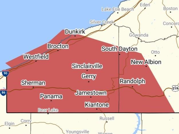
UPDATE: Another severe thunderstorm is in effect until 11:15 PM, this one for Chautauqua County and southwestern Cattaraugus County. At 9:59 PM, a severe thunderstorm was located near North East, Pennsylvania or 12 miles northeast of Erie, moving east at 45 MPH. Hazards associated with this storm include 70 MPH wind gusts and quarter-size hail. Hail damage to vehicles is expected. Expect considerable tree damage. Wind damage is also likely to mobile homes, roofs, and outbuildings.
Locations impacted include Jamestown, Dunkirk, Fredonia, Allegany State Park, Westfield, Lakewood, Falconer, Mayville, Clymer and Long Point State Park. This includes the following highways: I-90 between Exits 59 and 61, and I-86 between Exits 4 and 19.
Graphic by the National Weather Service