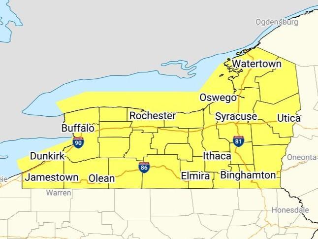
The National Weather Service's Storm Prediction Center has issued a tornado watch until 11:00 PM Wednesday for an area that includes all of Western New York. Primary threats include a few tornadoes and a couple intense tornadoes possible, scattered damaging wind gusts up to 70 MPH likely, and scattered large hail and isolated very large hail events up to two inches in diameter possible.
Forecasters say supercell thunderstorms should pose some threat for large hail and perhaps a few tornadoes as they move eastward during the late afternoon and evening hours across parts of Western and Central New York. A strong tornado appears possible if thunderstorms can remain at least semi-discrete during the evening. Thunderstorms will likely grow upscale into a bowing cluster later in the evening, with a greater threat for scattered to numerous severe/damaging winds up to 60-70 MPH.
Graphic by the National Weather Service